
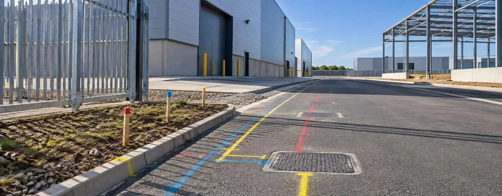
PAS128 Utility Surveys
Get in TouchAt Maverick Surveyors, we specialise in PAS128 utility surveys, providing essential and detailed mapping of underground utilities. Our surveys help identify the location and depth of utilities such as gas, water, electricity, and telecommunications lines.
These surveys are crucial for ensuring safety and avoiding costly mistakes during construction or maintenance projects. Our services cover the entire area, and we use advanced techniques and equipment to deliver reliable results.
Contact us today to secure an accurate utility mapping service.
What Is a PAS128 Utility Survey?
A PAS128 utility survey is a standardised method for detecting and mapping underground utilities. At Maverick Surveyors, we conduct these surveys to ensure accurate identification of utilities, minimising risks for construction projects.
The PAS128 standard requires specific survey methods, including desktop utility record search, geophysical surveying techniques, and the correct classification of utility detection, verification, and location.
Our surveys employ ground-penetrating radar (GPR) and electromagnetic location (EML) to pinpoint the precise position of pipes and cables. These methods allow us to detect utilities such as gas mains, water pipes, electrical cables, telecoms, and sewage lines.
By adhering to the British Standards Institution's PAS128 specification, we categorise surveys into four levels, from desktop assessments (D) to full verification (A), based on the need for accuracy and confidence in the data.
This approach provides a picture of below-ground infrastructure, ensuring your projects proceed safely and efficiently. For any enquiries or to schedule your PAS128 survey, contact us today.
Book PAS128 Utility Surveys Today
How Much Does a PAS128 Utility Survey Cost?
A PAS128 utility survey typically costs between £500 and £2,000, depending on the site's size and complexity. At Maverick Surveyors, we assess project requirements using a range of survey techniques such as electromagnetic location, ground-penetrating radar, and radio-frequency identification to accurately map subsurface utilities.
The cost is influenced by variables including site access, survey area, the presence of dense utility networks, and the requirement for additional data processing or verification. Specifications like locating utilities to different PAS128 accuracy levels (Quality Levels D to A) also impact pricing.
We provide detailed quotes and collaborate closely with clients to determine the most suitable solution for your specific needs, whether you are managing a residential development or a large commercial project. Contact us today to discuss your project and receive a tailored estimate.
Why Choose Maverick Surveyors for PAS128 Utility Surveys?
At Maverick Surveyors, we excel in conducting PAS128 utility surveys. Our team employs a combination of electromagnetic locating and ground-penetrating radar (GPR) to deliver precise and reliable mapping of underground utilities, such as gas, water, and electrical lines.
We follow the BS EN ISO 14654 standard, ensuring that our surveys meet stringent safety and quality requirements. Our equipment, like the RD8100 and IDS Duo GPR systems, allows us to identify and document utilities at different depths and materials.
Our surveys are especially beneficial for construction companies, infrastructure planners, and local authorities, helping them mitigate the risk of construction delays and avoid costly damages. By choosing us, you secure the benefit of a team that thoroughly understands the intricacies of utility detection.
Contact us to discuss your project requirements in detail.
What Are the Benefits of PAS128 Utility Surveys?
PAS128 utility surveys offer numerous benefits for construction and maintenance projects. We use ground-penetrating radar (GPR) and electromagnetic location (EML) methods to detect subsurface utilities with precision.
These surveys are vital for mapping utilities such as water, gas, electricity, and telecommunications, ensuring a understanding of underground infrastructure.
Improved Safety: Identifying underground utilities reduces the risk of accidents during excavation or construction. By using techniques like GPR, we minimise the chances of striking and damaging buried services.
Cost-Effective: Avoids expensive repairs and project delays caused by unmarked utilities. Surveys can significantly lower the costs associated with unforeseen utility damages.
Enhanced Planning: Provides detailed data to plan projects more effectively. With clear mapping, relocation of services can be anticipated, and design adjustments can be made early.
Regulatory Compliance: Ensures compliance with local regulations and standards, such as the Health and Safety Executive guidelines, safeguarding project legitimacy.
Our utility surveys are a crucial part of successful project management, enhancing safety, cost-efficiency, and adherence to regulations. Contact us to discuss your project requirements.
What Regulations Apply to PAS128 Utility Surveys?
PAS128 utility surveys adhere to strict UK standards to ensure accuracy and safety. At Maverick Surveyors, we follow these guidelines meticulously, facilitating compliance with industry regulations throughout .
The surveys are conducted under BSI PAS 128:2014 specifications, which classify survey detection into four quality levels: QL-D to QL-A. This classification helps by clearly defining the survey accuracy through levels such as visual inspection, geophysical detection, and verified excavation.
An important aspect of these specifications includes employing Ground Penetrating Radar (GPR) and Electromagnetic Location (EML) techniques for detection, ensuring precise mapping of buried services. These technologies help identify pipelines, cables and ducts accurately.
Furthermore, our experts use Global Navigation Satellite Systems (GNSS) for precise geolocation of utilities, enhancing data accuracy. This ensures projects meet legal and safety requirements for underground work, reducing the risk of costly legal consequences.
Contact us to discuss your utility survey needs today.
Speak to a PAS128 Utility Surveys Expert
Frequently Asked Questions
How long does a PAS128 utility survey take?
A PAS128 utility survey typically takes one to three days, depending on the scope and complexity of the site. The results are usually processed and delivered shortly after.
What equipment is used in PAS128 surveys?
At Maverick Surveyors, we use electromagnetic locators and ground-penetrating radar to detect and map utilities accurately. This technology helps us gather comprehensive data on underground infrastructures.
Is a PAS128 survey mandatory for all construction projects?
While it's not mandatory, a PAS128 survey is highly recommended for construction projects to prevent utility damage and ensure safety. It provides critical data for planning and risk management.
Can PAS128 surveys detect all types of utilities?
PAS128 surveys can detect most utilities, including gas, water, electric, and telecom lines. However, detection may vary based on the soil type and the depth of the utility.
How do I book a PAS128 utility survey?
Contact Maverick Surveyors directly to book your survey. We'll discuss your project's specific needs and provide a free, no-obligation quote.
Get a Free Quote for PAS128 Utility Surveys
For reliable utility mapping, choose Maverick Surveyors. Contact us today to get a free quote for PAS128 utility surveys and .