
Maverick Surveyors
Get in TouchAt Maverick Surveyors, we specialise in providing precise land, building, and underground surveying services for projects of all sizes throughout the UK. Our range of services, including GPR and utility detection, topographical surveys, laser scanning, and setting out, ensures that your project planning is informed by reliable information. Whether you're planning a new construction or seeking detailed site information, our expert team is equipped to meet your needs.
Get in touch with us today to learn more about our services and how we can assist your project.
Who Is Maverick Surveyors?
We're Maverick Surveyors, a dedicated team offering detailed surveying services across the UK. Our experts specialise in land, building, and underground surveys for projects ranging from residential developments to large-scale commercial enterprises. Using techniques such as ground-penetrating radar (GPR) and advanced laser scanning, we ensure that our clients receive precise and comprehensive site data.
Our GPR technology, for instance, is capable of detecting underground utilities and potential obstacles at depths of up to 20 metres, critical for safe excavation planning. Additionally, our high-definition laser scanning captures minute details of existing structures, aiding in renovation and heritage conservation efforts.
We adhere strictly to RICS standards, guaranteeing that our surveys are conducted with the utmost professionalism and accuracy.
We are committed to ensuring that your project planning is grounded in accurate and reliable information, enhancing efficiency and safety. Contact us to discuss how our services can meet the specific needs of your project.
What Surveying Services Does Maverick Surveyors Provide?
At Maverick Surveyors, we offer a diverse range of surveying services to support various aspects of your project:
GPR Surveys: Conduct ground-penetrating radar surveys to uncover underground features.
Underground Utility Surveys: Identify and map underground utilities to prevent project delays.
Land & Topographical Surveys: Deliver accurate land mapping for planning and development.
Building Measurement Surveys: Provide building dimensions and layout data.
PAS128 Utility Surveys: Comply with industry standards for utility detection and mapping.
3D Building Scanning Surveys: Capture detailed 3D representations of structures.
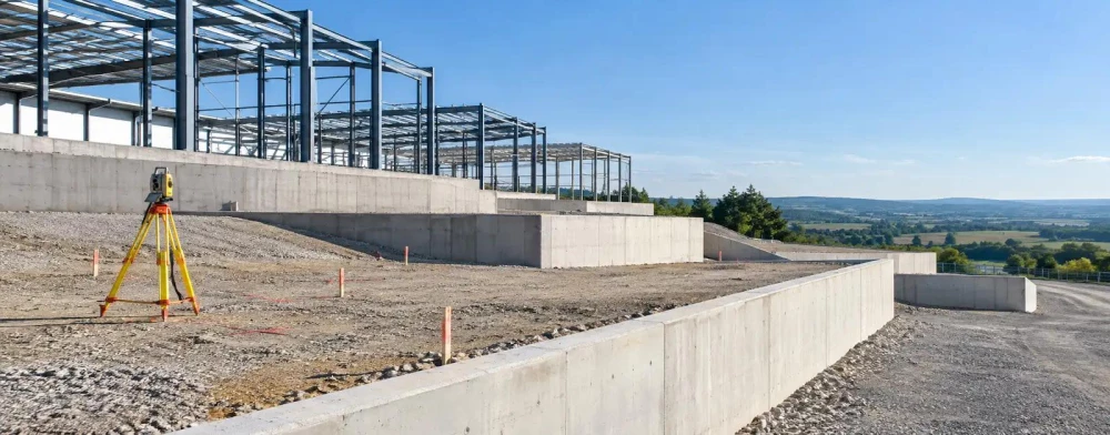
Construction Setting Out Surveys: Ensure construction is aligned with design specifications.
Pre-Drilling Clearance Surveys: Confirm safe drilling points to avoid utility strikes.
When Is Surveying Needed?
Surveying is crucial at various stages of a project to ensure accurate planning and execution. Before construction begins, surveys like underground utility detection and land mapping are essential to identify existing elements and optimise site use.
For refurbishment projects, building measurement or 3D scanning surveys provide critical data on current structures and conditions. During the construction phase, monitoring surveys help track movement or deformation in structures, ensuring safety and stability.
Additionally, surveys ensure compliance with industry standards such as PAS128 for underground utility detection and RICS guidelines for comprehensive analysis, safeguarding against unforeseen issues. Boundary surveys are crucial for property development to prevent legal disputes by accurately defining property lines.
Implementing these surveys aids in reducing project delays, controlling costs, and ensuring successful completion. If you need advice on surveying for your specific project or property type, don't hesitate to contact us.
Book Maverick Surveyors Services Today
How Does Maverick Surveyors Work?
Our process is structured to ensure precision and efficiency in every project, combining modern technology with industry standards to deliver reliable results.
Initial Consultation: We discuss the client's specific project needs and outline the survey's scope. During this phase, we also identify any particular constraints or requirements, such as using GPS or total station equipment.
Site Inspection: We conduct a thorough assessment of the site conditions, evaluating factors like terrain, accessibility, and potential hazards. This helps us plan the survey effectively.
Survey Execution: We implement selected surveying techniques, such as laser scanning or drone surveys, to collect data. These methods provide varying levels of detail and are chosen based on the project's requirements.
Data Analysis: Our team processes and interprets survey data, using CAD software to ensure accuracy and detail. We check all information against current land use and zoning regulations.
Report Delivery: We provide a detailed report with findings and recommendations, including maps, charts, and 3D models where necessary. This report is tailored to the needs of property developers, architects, and local authorities, guiding their next steps.
Feel free to reach out if you need any specific surveying service!
Who Does Maverick Surveyors Help?
Maverick Surveyors assists a wide variety of clients, including construction firms, architects, engineers, property developers, and local authorities. We provide crucial support for those requiring precise data for large-scale developments, renovations, and infrastructure projects.
Our expertise in topographical surveys, setting-out, and boundary analysis ensures that projects commence with reliable foundational data.
We serve housing associations and residential developers who need property condition assessments and detailed area measurements for compliance with RICS standards. Utilities companies also rely on us for sub-surface utility engineering (SUE) services, using ground-penetrating radar to identify and map existing infrastructure.
Our role in aiding decision-making processes encompasses both public and private sector projects across the UK. By delivering timely reports and leveraging advanced GIS mapping systems, we empower our clients to make informed choices. Contact us today to discuss how we can support your project needs.
How Quickly Can Maverick Surveyors Respond?
We aim to respond promptly to all project enquiries, usually initiating contact within two to three working days. Our survey scheduling is flexible, tailored to meet your project's timeline and urgency.
For urgent assessments, we often provide rapid site visits, particularly for residential properties requiring immediate attention due to structural concerns. We use laser measuring equipment for precise data gathering, ensuring our surveys align with RICS standards.
Our digital reporting tools allow us to swiftly compile and deliver comprehensive reports, often within a week after the survey. Whether you're dealing with a commercial property refurbishment or a new building development, our team is prepared to accommodate your needs.
Contact us to discuss your timelines and scheduling needs.
How Does Maverick Surveyors Ensure Quality and Compliance?
At Maverick Surveyors, we prioritise quality and compliance by adhering to recognised industry standards, such as PAS128 for utility surveys and BS 5837 for tree surveying in construction. Our team members undergo regular training to stay updated on best practices for surveying accuracy and safety protocols.
We use high-precision equipment, including 3D laser scanners and ground-penetrating radar (GPR) units, to capture detailed and accurate data. Our total stations and drone technology allow for efficient large-area surveys, making them ideal for commercial and residential developments.
We also perform post-processing with advanced software like AutoCAD and GIS systems to ensure comprehensive data analysis and precise mapping.
In addition to these measures, we conduct internal audits to continuously refine our procedures and maintain our ISO 9001 certification. Whether you're planning a new build or assessing a historic site, our solutions ensure compliance and excellence.
Contact us for a consultation to discuss your surveying needs.
Speak to a Maverick Surveyors Expert
Why Choose Maverick Surveyors?
Choosing Maverick Surveyors guarantees meticulous surveying with reliable data outputs. Our team provides a thorough range of surveying services, each designed to meet diverse client needs across various sectors.
Whether you require topographical surveys to determine surface features or underground surveys for subsurface mapping, we have you covered.
Comprehensive Services: From topographical to underground surveys, including boundary analysis and construction layout services.
Advanced Techniques: We use cutting-edge technology like laser scanning and drone photogrammetry to ensure precise measurements and data accuracy.
Expert Team: Our surveyors have years of industry experience and hold relevant certifications such as RICS. Their knowledge spans commercial, residential, and infrastructure projects.
Client-focused Approach: We provide customised solutions for your specific projects, addressing unique challenges and requirements in sectors from real estate to civil engineering.
Choose Maverick Surveyors for precise and efficient survey results tailored to your project's needs.
Frequently Asked Questions
What is a GPR Survey?
A GPR Survey at Maverick Surveyors uses ground-penetrating radar to identify subsurface utilities and features, aiding in construction planning and site safety.
How accurate are your topographical surveys?
Our topographical surveys achieve precision by using advanced equipment and methodologies, typically providing data within millimetres of accuracy.
What is the purpose of a PAS128 utility survey?
A PAS128 utility survey from Maverick Surveyors helps map buried utilities precisely, adhering to industry standards to minimise construction risks and delays.
Get a Free Quote
Contact Maverick Surveyors today to discuss your project requirements and request a personalised quote.